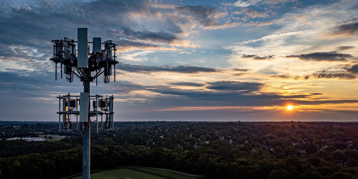
Drone Services for the Telecommunications Industry
Optimize Tower Inspections. Reduce Downtime. Improve Safety.
SkyHarvest Drones provides high-resolution aerial inspections and 3D mapping services for the telecommunications industry—helping network operators, tower maintenance crews, and wireless carriers inspect assets faster, safer, and with far greater precision.
Our FAA-certified drone pilots use zoom optics, 3D modeling, and AI-powered analysis to deliver detailed imagery of towers, antennas, guy wires, and remote facilities—without climbing, shutdowns, or costly delays.
Ready for Takeoff?
Contact us today to start mission planning with our team. We offer competitive pricing and customizable packages to fit your specific needs.
Drone Services
Cell Tower Inspections
Structural Condition Assessments
Structural Condition Assessments

Close-Up Imaging Without Climbing Risks
We inspect telecom towers with precision optics and advanced stabilization to safely deliver:
- High-resolution images of antennas, mounts, cables, and platforms
- Detection of corrosion, damage, or weathering on structural elements
- Visual line-of-sight (LOS) analysis for planned upgrades
Our drone workflows reduce man-hours at height and enable remote inspections in rugged or remote areas.
Structural Condition Assessments
Structural Condition Assessments
Structural Condition Assessments

Ensure Safety and Compliance Without Disruption
Our drones capture visual and thermal data to monitor tower integrity over time, supporting:
- Maintenance planning and repair prioritization
- Documentation for OSHA, TIA/EIA, and industry compliance
- Damage verification after storms or seismic events
Paired with automated flight paths and repeatable capture angles, we deliver consistent, time-stamped documentation.
3D Modeling & Digital Twins
Post-Storm Damage Inspections
Post-Storm Damage Inspections

Create Interactive Tower Models for Planning & Asset Management
Using photogrammetry and LiDAR, we generate accurate 3D models and point clouds of towers and equipment—ideal for:
- Antenna mapping and placement validation
- BIM integration and upgrade planning
- Asset cataloging and structural simulation
Eliminate guesswork and accelerate collaboration between field teams, engineers, and vendors.
Post-Storm Damage Inspections
Post-Storm Damage Inspections
Post-Storm Damage Inspections

Rapid Deployment When Network Downtime Isn’t an Option
We deploy quickly after weather events to assess damage across towers, shelters, and supporting infrastructure.
- Identify displaced antennas, broken guy wires, or compromised mounts
- Document lightning strikes, wind shear, or flooding
- Deliver actionable reports for repairs and insurance claims
Keep your crews focused on restoration while we provide the data to guide them.
Whether you’re managing a regional upgrade or assessing storm damage across dozens of towers, SkyHarvest delivers safe, fast, and accurate aerial intelligence for every telecom mission.
SkyHarvest Drones

